
Bikeway Basics
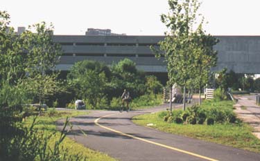
The Minuteman Bikeway connects to the Alewife MBTA Station in Cambridge, providing transportation access to subway and bus service.
| Location | Bedford, Lexington, Arlington, and Cambridge – Massachusetts. |
| Maps | You can download maps of the Minuteman Bikeway here:
|
| End points | Alewife Station, Cambridge. Depot Park/South Street, Bedford. |
| Length | 10 miles from Alewife Station to Bedford, with mile-marker posts. |
| Surfact | Asphalt pavement, 12 feet wide. |
| Terrain | Gently rolling |
| Uses | Bicycling, walking, jogging, in-line skating, cross-country skiing. No motorized vehicles allowed, except for powered wheelchairs. |
| Snow Removal | The bikeway is plowed during the winter months. |
| Accessibility | Most at-grade street crossings along the bikeway are assessible for people with physical disabilities – including the main bikeway entrances in Bedford, Lexington Center, Arlington Center, and Cambridge. |
| Refreshments and toilets | Available at Depot Park in Bedford, Thorndike Field in Arlington (seasonal outhouses), Lexington Visitor’s Center, Alewife Station, and nearby business districts along the bikeway. |
| Brochure | You can download the new Bikeway Brochure and Map below.
|
| Bikeway Logo |
Click for information on downloading artwork files of the Minuteman Bikeway logo. |